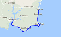
Day Thirty Six - Salcombe to Torcross 20.8km (12.9 miles).
Time on route 6:00hrs, walking time 5:50hrs.
Wednesday 18 January 2017
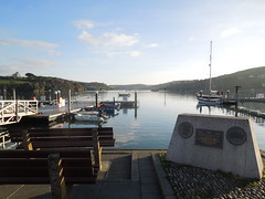
I caught the bus down to Salcombe and enjoyed a coffee in the delightfully nautical Captain Morgan's whilst awaiting the ferry. I bumped into a couple of guys at the jetty just climbing off their paddle-boards. They had paddled down from Kingsbridge taking the opportunity of a calm estuary. They said it was a treat to come down, have breakfast in Salcombe, then paddle back. Now that's the way to spend a morning.
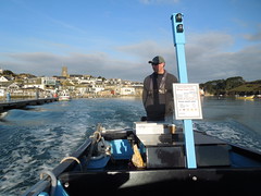
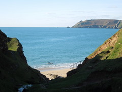
Salcombe glistened in the sun as I crossed yet another estuary.
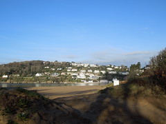
Looking back on Salcombe from East Portlemouth.
It was an easy path out of Salcombe across Portsmouth Down and Deckler's Cliff. The winter sun created strong shadows down the gullies.
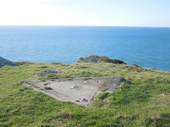
At Prawle Point there is a Coastwatch Institution station and small museum. Neither of which I appear to have photographed directing my camera instead on this triangular piece of concrete. I suspect it was the base of a telescope once.
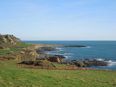
More gentle walking across what my guidebook told me was an early Pleistocene cliff line (I confess to not knowing my Pleistocene from my Plasticine) and past Langerstone Point.
In Lanacombe Bay you find a grand dwelling that is being magnificently refurbished with the sign "Welcome to Maelcombe", followed by a not so friendly clarification sign stating "Keep Out".
The path became more fiddly to walk. It started to twist and turn both in the horizontal and vertical directions. The sort of path where you see your destination but sometimes you're actually walking away from it. Added to this big stones/boulders under foot meant I had to watch my feet the whole time.
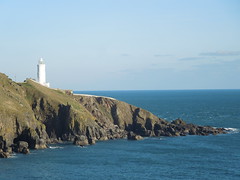
Eventually Start Point loomed into view.
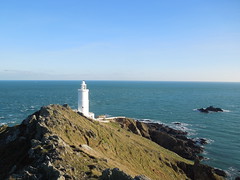
I'm not sure if the path goes right down to it, but I did - well as far as I was able without trespassing.
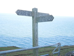
I hugged the ridge east over to it and walked the service road back west whereupon I did a double take on this sign. It appeared to have very large distances on it and then I realised, to my delight, that it was a marker for the whole route! In imperial terms, 462 miles walked, 168 to go. A rough calculation in my head told me that I was nearly 3/4 of the way around the route (just 10 miles more). What a welcome surprise.
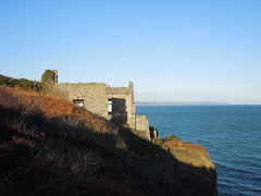
This part of Hallsands has seen better days and the new village is built further inland on the cliff top. The old village was destroyed by the sea after dredging of its protective sand bar took place from 1897 onwards (more here).
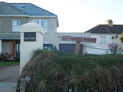
A sign alerted me to danger in Beesands.
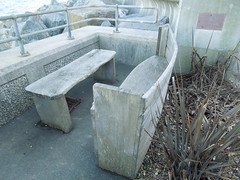
And, once safely clear, I marvelled at the creativity of turning a rowing boat into a bench.
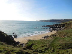
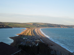
Just before Torcross you ascend the cliffs circumventing an old quarry. This has the advantage of affording wonderful views of Slapton Sands (with Slapton Ley on the left). My route for the next day.
Time on route 6:00hrs, walking time 5:50hrs.
Wednesday 18 January 2017
I caught the bus down to Salcombe and enjoyed a coffee in the delightfully nautical Captain Morgan's whilst awaiting the ferry. I bumped into a couple of guys at the jetty just climbing off their paddle-boards. They had paddled down from Kingsbridge taking the opportunity of a calm estuary. They said it was a treat to come down, have breakfast in Salcombe, then paddle back. Now that's the way to spend a morning.
Salcombe glistened in the sun as I crossed yet another estuary.
Looking back on Salcombe from East Portlemouth.
It was an easy path out of Salcombe across Portsmouth Down and Deckler's Cliff. The winter sun created strong shadows down the gullies.
At Prawle Point there is a Coastwatch Institution station and small museum. Neither of which I appear to have photographed directing my camera instead on this triangular piece of concrete. I suspect it was the base of a telescope once.
More gentle walking across what my guidebook told me was an early Pleistocene cliff line (I confess to not knowing my Pleistocene from my Plasticine) and past Langerstone Point.
In Lanacombe Bay you find a grand dwelling that is being magnificently refurbished with the sign "Welcome to Maelcombe", followed by a not so friendly clarification sign stating "Keep Out".
The path became more fiddly to walk. It started to twist and turn both in the horizontal and vertical directions. The sort of path where you see your destination but sometimes you're actually walking away from it. Added to this big stones/boulders under foot meant I had to watch my feet the whole time.
Eventually Start Point loomed into view.
I'm not sure if the path goes right down to it, but I did - well as far as I was able without trespassing.
I hugged the ridge east over to it and walked the service road back west whereupon I did a double take on this sign. It appeared to have very large distances on it and then I realised, to my delight, that it was a marker for the whole route! In imperial terms, 462 miles walked, 168 to go. A rough calculation in my head told me that I was nearly 3/4 of the way around the route (just 10 miles more). What a welcome surprise.
This part of Hallsands has seen better days and the new village is built further inland on the cliff top. The old village was destroyed by the sea after dredging of its protective sand bar took place from 1897 onwards (more here).
A sign alerted me to danger in Beesands.
And, once safely clear, I marvelled at the creativity of turning a rowing boat into a bench.
Just before Torcross you ascend the cliffs circumventing an old quarry. This has the advantage of affording wonderful views of Slapton Sands (with Slapton Ley on the left). My route for the next day.
No comments:
Post a Comment