Monday 30 January 2017

Against the Wind to Blackpool

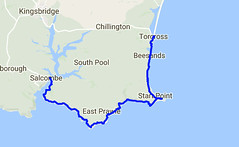
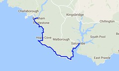
Day Thirty Seven - Torcross to Stoke Fleming 8.7km (5.3 miles).
Time on route 3:00hrs, walking time 2:30hrs.


Thursday 19 January 2017
Day 37 map
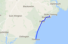
It was a short day today as I needed to get home but I wanted to get some miles under my feet as, otherwise, the next leg is ~25km which is a tough one to manage with short daylight hours and public transport.  I drove to Stoke Fleming, parked up, and took the bus back down to Torcross.  These bus drivers are quite awesome, navigating their large double decker buses down these narrow roads.

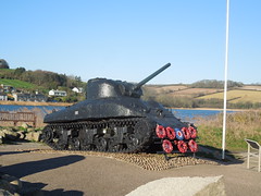
At the south end of Slapton Ley is a US Sherman tank, one of the memorials along Slapton Sands to commemorate the many (mainly American) lives that were lost during Exercise Tiger in 1944.
2017-01-19_1 Slapton Tank
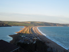
The wind was from the north east and strong so I wrapped up well and marched the 4km up the sands. No photos when it's windy dear reader(s).

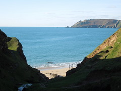
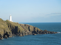
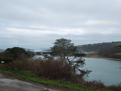
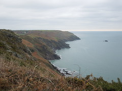
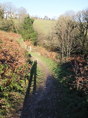
The path then headed off inland and, with the low sun behind me, it make a striking shot.
2017-01-19_2 Strete
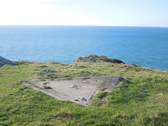
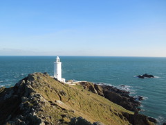
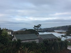
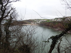
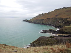
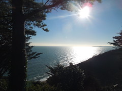
This is turning the other way looking south.
2017-01-19_3 Start Bay
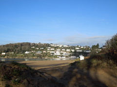
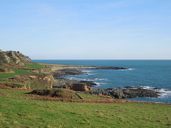
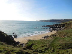
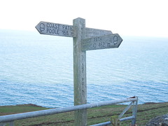
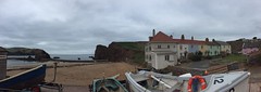
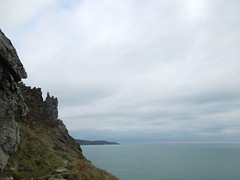
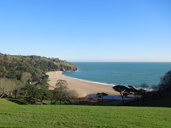
I climbed up high criss-crossing the A379 getting slightly lost near Strete where the signs disappeared and my map didn't reflect the rerouting of the last couple of years.  Anyway, a little wandering up and down a field didn't hurt and I was back on path looking down on Blackpool Sands.
2017-01-19_4 Blackpool Sands
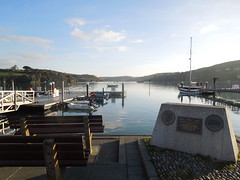
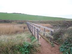
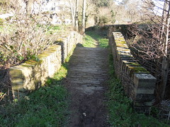
Nearing the beach is a pretty stone bridge.
2017-01-19_4 Blackpool Bridge 2
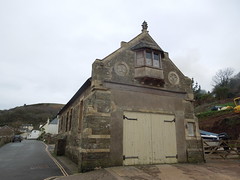
There was a wonderful teashop at Blackpool Sands, the Venus Cafe.  Just south of the Sands is a naturist beach.  Not that I saw much activity on a cold, windy day on January.  I mentioned to a friend recently that the cafe was wonderful to which he remarked "Nude beaches always have the best cafes".  I didn't ask him how he knew but it made me smile.  Perhaps once I've finished the Coast Path I should test his theory?

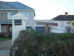
Anyway, a final push up, across the A379 again, to Stoke Fleming and the end of another day (half day) on the path.

Sunday 29 January 2017

Nearly Three Quarters

Day Thirty Six - Salcombe to Torcross 20.8km (12.9 miles).
Time on route 6:00hrs, walking time 5:50hrs.


Wednesday 18 January 2017
Day 36 map
I caught the bus down to Salcombe and enjoyed a coffee in the delightfully nautical Captain Morgan's whilst awaiting the ferry.  I bumped into a couple of guys at the jetty just climbing off their paddle-boards.  They had paddled down from Kingsbridge taking the opportunity of a calm estuary.  They said it was a treat to come down, have breakfast in Salcombe, then paddle back.  Now that's the way to spend a morning.
2017-01-18_1 Salcombe Harbour
Salcombe glistened in the sun as I crossed yet another estuary.
2017-01-18_1 Salcombe 09.19
Looking back on Salcombe from East Portlemouth.
2017-01-18_1 Salcombe 22.32
It was an easy path out of Salcombe across Portsmouth Down and Deckler's Cliff.  The winter sun created strong shadows down the gullies.
2017-01-18_2 Near Decklers Cliff
At Prawle Point there is a Coastwatch Institution station and small museum.  Neither of which I appear to have photographed directing my camera instead on this triangular piece of concrete.  I suspect it was the base of a telescope once.
2017-01-18_3 Prawle Point
More gentle walking across what my guidebook told me was an early Pleistocene cliff line (I confess to not knowing my Pleistocene from my Plasticine) and past Langerstone Point.
2017-01-18_4 Nr Langerstone Point
In Lanacombe Bay you find a grand dwelling that is being magnificently refurbished with the sign "Welcome to Maelcombe", followed by a not so friendly clarification sign stating "Keep Out".
2017-01-18_5 Lannacombe Bay 4.56.26
The path became more fiddly to walk.  It started to twist and turn both in the horizontal and vertical directions. The sort of path where you see your destination but sometimes you're actually walking away from it.  Added to this big stones/boulders under foot meant I had to watch my feet the whole time.

Eventually Start Point loomed into view.
2017-01-18_6 Start Point 06.38
I'm not sure if the path goes right down to it, but I did - well as far as I was able without trespassing.
2017-01-18_6 Start Point 21.13
I hugged the ridge east over to it and walked the service road back west whereupon I did a double take on this sign.  It appeared to have very large distances on it and then I realised, to my delight, that it was a marker for the whole route!  In imperial terms, 462 miles walked, 168 to go.  A rough calculation in my head told me that I was nearly 3/4 of the way around the route (just 10 miles more).  What a welcome surprise.
2017-01-18_6 Start Point 31.37
This part of Hallsands has seen better days and the new village is built further inland on the cliff top.  The old village was destroyed by the sea after dredging of its protective sand bar took place from 1897 onwards (more here).
2017-01-18_7 Hallsands
A sign alerted me to danger in Beesands.
2017-01-18_8 Beesands7.56
And, once safely clear, I marvelled at the creativity of turning a rowing boat into a bench.
2017-01-18_8 Beesands4.10
Just before Torcross you ascend the cliffs circumventing an old quarry.  This has the advantage of affording wonderful views of Slapton Sands (with Slapton Ley on the left).  My route for the next day.
2017-01-18_9 Slapton Ley 5.11

Saturday 28 January 2017

Cold and Calm to start the Year

Day Thirty Five - Bantham to Salcombe 20.3km (12.6 miles).
Time on route 5:30hrs, walking time 5:30hrs.


Tuesday 17 January 2017
Day 35 map
For the legs south from Bantham I used Kingsbridge as a hub.  It was a prompt start and I parked at my B&B in time to catch the 0810 bus from there to Thurlstone.  The bus driver only charged me £1 as it was a school run and he said that's what everyone else was charged, even those I was twice the height of the other passengers!  Anyway, I then walked a kilometre down to the river Avon to pick up my route from 2016.

I was pleased to see the tea shop I'd found in September was open for a coffee at 0900 so I started my walk with coffee and a view.
2017-01-17_1 Avon River
You can see Burgh Island to the left of this photo.  So peaceful and still.
2017-01-17_1 River Avon
Anyway, once sated I head off into the cold, but calm day.  Just past Thurlestone golf course you drop down to South Milton and cross the Ley.  This is the second largest reed bed in Devon and you traverse it via a 73m footbridge.
2017-01-17 _3 South Milton Ley 5.59
A heron breakfasting.
2017-01-17 _3 South Milton Ley 6.40
Soon after you enter Outer and then Inner Hope, with the harbour being particularly photogenic.
2017-01-17_4 Inner Hope
The old lifeboat station had a little treat for me...
2017-01-17 _4 Inner and Outer Hope  3.52
... a somewhat weathered benchmark.
2017-01-17 _4 Inner and Outer Hope  3.14
I climbed out and glanced back at Hope Harbour.  The pastel coloured cottages make a scenic view.
2017-01-17 _4 Inner and Outer Hope  6.04
It was a cold day so I didn't linger much, however I had to detour at Bolt Tail.  I used to work with the Royal Navy hydrographers and I knew they had a survey point somewhere on this promontory.  I even had the National Grid coordinates on me but without a station description (or a GPS) it was a pretty fruitless hunt for a survey marker flush with the ground, positioned 20 years ago and no doubt buried by ground cover by now.

The way ahead was clear and undulating, over Bolberry Down and The Warren (again, another survey marker here - again a failure to find).  It's a quiet path with few other walkers and limited refreshment opportunities - fine by me.
2017-01-17_5 The Warren
I passed Bolt Head and looked back at it from Sharp Tor.
2017-01-17_6 Bolt Head
Sharp Tor.
2017-01-17 _7 Sharp Tor 7.35
Then around the corner into South Sands.
2017-01-17_8 South Sands
Once past this the path follows (mainly) a road into Salcombe.
2017-01-18_1 Salcombe 12.36
I checked out my ferry jetty for the next day.  The East Portlemouth ferry departs from a more northerly point in the winter and I always like to check out these things ahead of time if possible.

I caught a bus back to Kingsbridge - enjoying their lovely mosaics on arrival.
2017-01-17_9 Kingsbridge 28
2017-01-17_9 Kingsbridge 08
Kingsbridge is a great hub: buses, a decent B&B (Ashleigh House) and a good choice of restaurants so I dined well and slept like a queen.