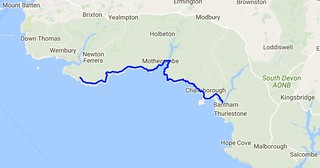
Day Thirty Four - Noss Mayo to Bigbury-on-Sea 20.6km (12.8 miles).
Time on route 6:50hrs, walking time 5:20hrs.
Friday 09 September 2016
I was in no hurry to leave this morning. I had to wade the River Erme and you can only do that an hour each side of low tide. And this was at 1653 BST (OK and also at 0430 but that was daft). So I had a terribly lazy breakfast and chatted to Roger, my B&B host.
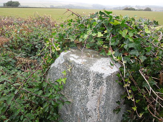
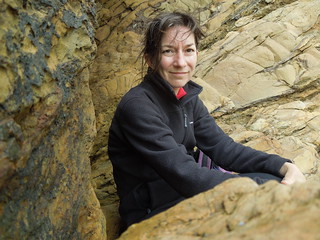
Roger is a retired antiques dealer but initially trained as a surveyor back in his youth. We therefore had an interesting discussion about trig pillars. I'd said there was one near the path that I was going to bag on my way out that morning. "Ah yes, he said, "you passed it on your way here. "No, I didn't," I replied, "that wasn't a proper trig pillar." I wish I'd taken a photo of it. It was certainly trig like - square based, indentation in top for a reflector etc but it wasn't an OS one. It was too short and too wide. And there was no flush bracket. And it wasn't at the top of the hill but beside a path. I showed Roger on the map where the OS trig was. He remonstrated that perhaps the farmer had moved it.
Anyway, as he had nothing better to do than prove me wrong, he wandered out with me. As we neared where I thought it would be I explained it'd be in the hedge, probably with a gap in the bushes where other trig baggers had ascended, that it could be damaged on the top from hedge cutting, it'd have a 3 pronged spider in the top etc.
Roger remained unconvinced and I should have taken him up on his £10 bet. Wished I had as, ta dah, guess what we came across! TP0338.
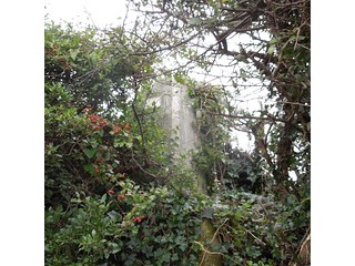
"Well I never," he muttered. "Perhaps you do know what you're talking about."
You can even see the damage the hedge trimmer has done.
Roger joined me for a km or so and we strolled the Revelstoke Drive. At one stage Roger asked me about Mean Sea Level. "As you know, mean sea level varies so how can you measure heights to it?" he quizzed. A few minutes later, after hearing my explanation, he wearily said "OK, I guess you know your stuff don't you?" And then rued that he hadn't tested me on my antiques knowledge whilst I'd been at his B&B so I could benefit from his specialist knowledge too. I'd have been hopeless!
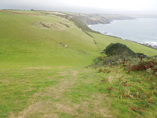
Once off the drive the path started to undulate more.
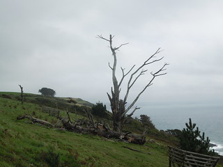
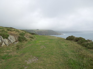
The photos never portray the steepness adequately but today's leg was billed as the most strenuous in South Devon.
Grey clouds followed me all day but the rain held off which was kind. The wind was fierce though with significant gusts. Just what I like when I'm battling stiff descents and ascents...
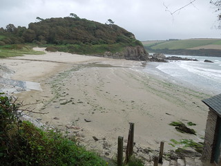
I strolled across Meadowsfoot Beach.
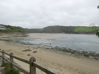
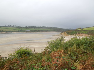
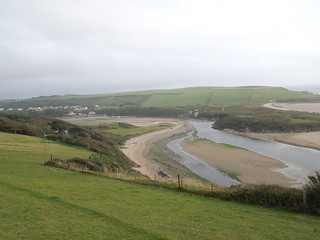
And as I turned the corner got my first view of the River Erme.
Up at Mothercombe, a 300m climb up a road, there is a seasonal cafe so I plonked myself there for a while warming up on tea. I then tired of this and headed down to the beach to see if anyone had crossed the river yet. I suspected not as it was 2.5 hours before low tide. Roger had told me I could cross it with 2 hours to go but as he was over 6' in height I took his "don't worry - you'll be fine" with a pinch of salt.
So I sat and waited.
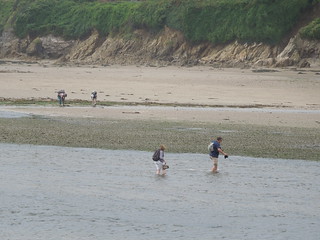
Soon a chap bounced past and jittered backwards and forwards by the river looking for a point to cross. He managed to wade across but I couldn't see how deep it got. But it looked safe enough. I gave it another 30 minutes then stripped down to my shorts, carried my boots and headed across.
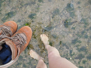
It got knee deep as I waded across. I didn't realise but I had an audience the other side who gave me a round of applause as I climbed out. Having proved it was possible, others started de-booting and wading across.
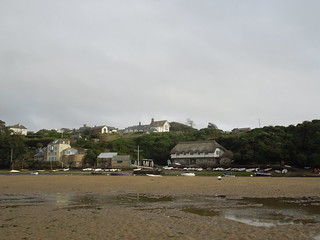
I dried off, re-shoed and headed off pleased that I was an hour ahead of schedule. A final look back at the Erme.
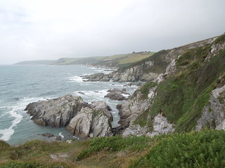
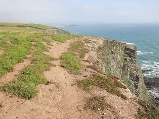
I am usually a stickler for following the path to the tee. However with the strong gusts of wind even I decided that walking 1m away from the cliff edge was not sensible and I gave the path a few metres berth at this point.
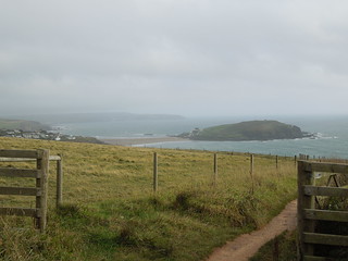
Burgh Island appeared on my horizon now. My end point for the day.
Getting closer.
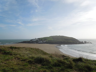
And closer. Burgh Island has tidal access and a somewhat fancy hotel on it (Burgh Island). I believe black tie is de rigueur for dinner.
I decided to see if I could push on to the River Avon. I knew the ferry had finished for the day but thought if I at least got as far as I could from the west it would help the next section.
So I did. In fact I walked quite a way across the sand flats towards Bantham before heading back to the car pondering how I was going to cross this river before the ferry closed for the season.
Time on route 6:50hrs, walking time 5:20hrs.
Friday 09 September 2016
I was in no hurry to leave this morning. I had to wade the River Erme and you can only do that an hour each side of low tide. And this was at 1653 BST (OK and also at 0430 but that was daft). So I had a terribly lazy breakfast and chatted to Roger, my B&B host.
Roger is a retired antiques dealer but initially trained as a surveyor back in his youth. We therefore had an interesting discussion about trig pillars. I'd said there was one near the path that I was going to bag on my way out that morning. "Ah yes, he said, "you passed it on your way here. "No, I didn't," I replied, "that wasn't a proper trig pillar." I wish I'd taken a photo of it. It was certainly trig like - square based, indentation in top for a reflector etc but it wasn't an OS one. It was too short and too wide. And there was no flush bracket. And it wasn't at the top of the hill but beside a path. I showed Roger on the map where the OS trig was. He remonstrated that perhaps the farmer had moved it.
Anyway, as he had nothing better to do than prove me wrong, he wandered out with me. As we neared where I thought it would be I explained it'd be in the hedge, probably with a gap in the bushes where other trig baggers had ascended, that it could be damaged on the top from hedge cutting, it'd have a 3 pronged spider in the top etc.
Roger remained unconvinced and I should have taken him up on his £10 bet. Wished I had as, ta dah, guess what we came across! TP0338.
"Well I never," he muttered. "Perhaps you do know what you're talking about."
You can even see the damage the hedge trimmer has done.
Roger joined me for a km or so and we strolled the Revelstoke Drive. At one stage Roger asked me about Mean Sea Level. "As you know, mean sea level varies so how can you measure heights to it?" he quizzed. A few minutes later, after hearing my explanation, he wearily said "OK, I guess you know your stuff don't you?" And then rued that he hadn't tested me on my antiques knowledge whilst I'd been at his B&B so I could benefit from his specialist knowledge too. I'd have been hopeless!
Once off the drive the path started to undulate more.
The photos never portray the steepness adequately but today's leg was billed as the most strenuous in South Devon.
Grey clouds followed me all day but the rain held off which was kind. The wind was fierce though with significant gusts. Just what I like when I'm battling stiff descents and ascents...
I strolled across Meadowsfoot Beach.
And as I turned the corner got my first view of the River Erme.
Up at Mothercombe, a 300m climb up a road, there is a seasonal cafe so I plonked myself there for a while warming up on tea. I then tired of this and headed down to the beach to see if anyone had crossed the river yet. I suspected not as it was 2.5 hours before low tide. Roger had told me I could cross it with 2 hours to go but as he was over 6' in height I took his "don't worry - you'll be fine" with a pinch of salt.
So I sat and waited.
Soon a chap bounced past and jittered backwards and forwards by the river looking for a point to cross. He managed to wade across but I couldn't see how deep it got. But it looked safe enough. I gave it another 30 minutes then stripped down to my shorts, carried my boots and headed across.
It got knee deep as I waded across. I didn't realise but I had an audience the other side who gave me a round of applause as I climbed out. Having proved it was possible, others started de-booting and wading across.
I dried off, re-shoed and headed off pleased that I was an hour ahead of schedule. A final look back at the Erme.
I am usually a stickler for following the path to the tee. However with the strong gusts of wind even I decided that walking 1m away from the cliff edge was not sensible and I gave the path a few metres berth at this point.
Burgh Island appeared on my horizon now. My end point for the day.
Getting closer.
And closer. Burgh Island has tidal access and a somewhat fancy hotel on it (Burgh Island). I believe black tie is de rigueur for dinner.
I decided to see if I could push on to the River Avon. I knew the ferry had finished for the day but thought if I at least got as far as I could from the west it would help the next section.
So I did. In fact I walked quite a way across the sand flats towards Bantham before heading back to the car pondering how I was going to cross this river before the ferry closed for the season.
No comments:
Post a Comment