Day Thirteen - Port Isaac to Padstow 18.9km (11.7 miles).
Time on route 5:00hrs, walking time 4:45hrs.
Saturday 20 December 2014
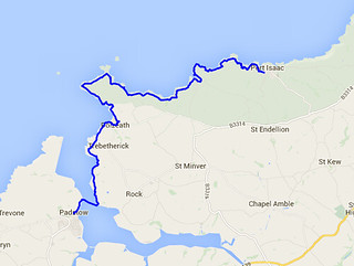
It was my an ambition to reach Padstow before the end of 2014. The Ordnance Survey guide book one runs from Minehead to Padstow so it's a neat ending. It is much harder to walk the coast path at this time of year: the hours of daylight are shorter, the weather more inclement and the public transport curtailed. I had one last leg to do and I brigaded the family to help me out.
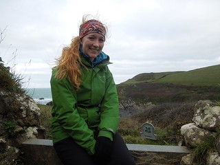
So Rog and Caitlin dropped us (Riona and me) at Port Isaac before driving round to Rock where they left the car. They then headed up the coast path to meet us. Riona and I had a 45 min head start on them, leaving Port Isaac at a prompt 0845.
We nearly didn't walk today as the weather forecast was for strong winds. At the beginning of the week the prediction was for winds up to 28mph which was outside of my comfort zone. I even had a moan to my Met Office colleagues about their forecast (like there is anything they can do about a low pressure over England). Anyway, by yesterday the forecast was only 20mph winds which although breezy, was do-able.
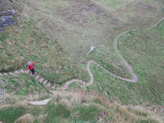
The first stretch is quite strenuous with steep descents and climbs. Nothing unusual for the SWCP but a tad more challenging due to the wind in our faces.
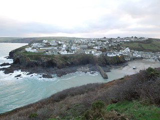
There's not much at Port Quin. Not even sea.
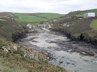
Just out of Port Quin is Doyden Castle.

We had a quick coffee stop at the delightful Lundy Hole.

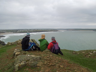
We eventually met up with Rog and Caitlin by Pentire Point.
We were a tad concerned when we met them. We knew they'd started out at 0930, and meeting them at 1145 meant we still had 2 hours 15 mins to walk. This didn't seem right according to the distance left on the map. And it wasn't. Apparently they'd had an enjoyable coffee stop for 30 minutes in Polzeath!
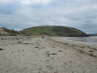
This part of the walk, into Rock, was far flatter (you can't get much flatter than a beach) and our route initially undulated over fields, then increasingly dunes.
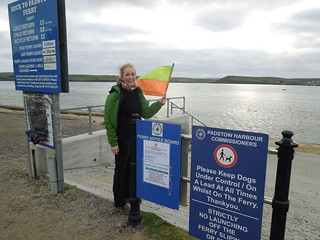
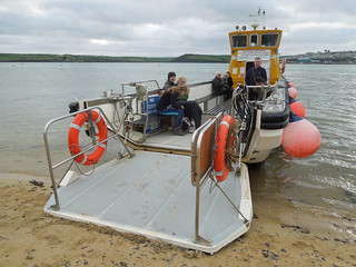
Once in Rock we realised we had time to hop across to Padstow. This means that I can pick up the next leg from the west side of the Camel Estuary in 2015. To hail the ferry you have to wave a flag.
And this would have worked if we hadn't coincided with their lunch break (timing is everything). However, we waited another 15 mins and were duly transported across to Padstow for tea and chips.

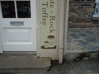
This is a bit sad - a little benchmark peeping out from under a shop sign.
All in, a great day on the path with the family. Shame they can't all be like that.
Time on route 5:00hrs, walking time 4:45hrs.
Saturday 20 December 2014
It was my an ambition to reach Padstow before the end of 2014. The Ordnance Survey guide book one runs from Minehead to Padstow so it's a neat ending. It is much harder to walk the coast path at this time of year: the hours of daylight are shorter, the weather more inclement and the public transport curtailed. I had one last leg to do and I brigaded the family to help me out.
So Rog and Caitlin dropped us (Riona and me) at Port Isaac before driving round to Rock where they left the car. They then headed up the coast path to meet us. Riona and I had a 45 min head start on them, leaving Port Isaac at a prompt 0845.
We nearly didn't walk today as the weather forecast was for strong winds. At the beginning of the week the prediction was for winds up to 28mph which was outside of my comfort zone. I even had a moan to my Met Office colleagues about their forecast (like there is anything they can do about a low pressure over England). Anyway, by yesterday the forecast was only 20mph winds which although breezy, was do-able.
The first stretch is quite strenuous with steep descents and climbs. Nothing unusual for the SWCP but a tad more challenging due to the wind in our faces.
There's not much at Port Quin. Not even sea.
Just out of Port Quin is Doyden Castle.
We had a quick coffee stop at the delightful Lundy Hole.
We eventually met up with Rog and Caitlin by Pentire Point.
We were a tad concerned when we met them. We knew they'd started out at 0930, and meeting them at 1145 meant we still had 2 hours 15 mins to walk. This didn't seem right according to the distance left on the map. And it wasn't. Apparently they'd had an enjoyable coffee stop for 30 minutes in Polzeath!
This part of the walk, into Rock, was far flatter (you can't get much flatter than a beach) and our route initially undulated over fields, then increasingly dunes.
Once in Rock we realised we had time to hop across to Padstow. This means that I can pick up the next leg from the west side of the Camel Estuary in 2015. To hail the ferry you have to wave a flag.
And this would have worked if we hadn't coincided with their lunch break (timing is everything). However, we waited another 15 mins and were duly transported across to Padstow for tea and chips.
This is a bit sad - a little benchmark peeping out from under a shop sign.
All in, a great day on the path with the family. Shame they can't all be like that.
No comments:
Post a Comment